The Two Fires featured on this page have key factors in common:
- Utter Devastion to the Areas Affected
- Lives Ruined or Lost
- Little or No Warning
- Key Chart Elements
|
VICTORIA-AUSTRALIA'S 2009 FIRESTORM
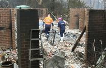
- Australia is used to Summer Firestorms. That is not unusual. However, walls of flame, 240 feet high; NOT so usual. A "once in a century" heatwave, low humidity and strong winds coupled with not enough forest burn-out set the stage for this nightmare. Also "lighting the match" was arson.
- Rivulets of melted metal that looked like liquid mercury, but used to be cars could be see. Fathers leaving the keys in the ignition with the motor running ... children & dog in the back seat ... while he ran to grab just one more item; would turn around to find the car and everything in it burnt to a crisp. Cars could not outrun this fire it moved so fast.
- To make matters even harder to take was the fact that while Victoria was burning in the South ... to the North, Australia was under water! 14 inches of rain in the Queensland State caused flash-flooding in Innisfail. 3000 homes were flooded by torrential rains and 2 Cyclones.
- Sugar cane & cattle industries have been decimated by the floods with tens of thousands of poor stranded cows starving to death.
|
- David Packham is a bushfire scientist & researcher at Monash University. He has worked in this area for 50 years.
- On January 25th, 2009, Packham wrote a letter to "The Weekly Times" stating that Victoria was sitting on forest fuel levels to the tune of 660 Hiroshima Bombs. He warned that up to 100 people might die in the ensuing inferno.
- Mr. David Packham saw extremely low humidity, high winds and temperatures in the 100's (F). His prediction was the result of weather forecasts from the Bureau of Meterology for extreme conditions expected for: Saturday, Feb 7th 2009.
- He stated his prediction (on Thursday, Feb 5th, 2009) for the worst fires in 50 years ... equivalent to a "nuclear strike"; after seeing the weather forecast for that Saturday.
- Mr. Packham was proved to be correct.
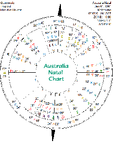
For these fires, the chart being used is for midnight on Saturday Morning
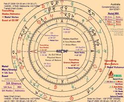
Saturn and Uranus as it turns out were in exact opposition
on Feb 5th 2009 at GMT ~ 11:00 AM
|
- Just Reported 02-07-2009 - Australia: gale force winds and 47ºC temps kill 14 people, destroyed homes and caused evacuations in Southeastern Australia. But, the deaths occurred in Victoria to the Northwest...New South Wales and South Australia also affected. Update: 02-08-2009 - This event is now being called worse than "Ash Wednesday", which occurred in 1983 when 75 people died.
- Just Reported 02-07-2009 - Queensland Australia is being decimated by flash floods and huge tides.
- Just Reported 02-07-2009 - Hundred of motorists trapped in cars, thousands of schools closed and more heavy snowfall: as the U.K. gets inundated by freezing weather & blizzard conditions. Some Britons say they have never seen anything like it before.
|
| You'd Think This Had to Be from a Motion Picture .... It Isn't |
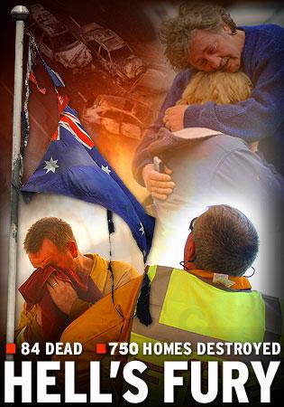 |
| Australia's Victoria Province Devastated |
|
| Victoria Province on the Southeast Australian Coast is experiencing devastation. Entire towns have been wiped out. A well known T.V. anchor dies in the blaze. The fires have been fueled by:
- Temperatures in the 100's-120º
-
Walls of flame 4 stories high have been described.
- The area has been without rain for 8 weeks.
- 100 dead so far
|
| This Horror Story is Still Being Written ..... |
In the Current Solar Eclipse World Chart (26 Jan 2009), Destructive Fires are indicated
as is "Dangerous Weather".
In the World Chart: Melbourne, the capital of Victoria Territory has astrological pictures similar to the ones that over California during its "Montecito Fires".The current Lunar Eclipse (9 Feb 2009)
also indicates
"Destructive, hard-to-control fires"Link to More on this story
|
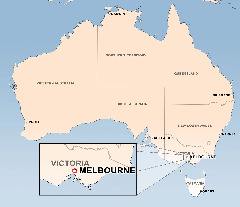 |
| Click Image to Enlarge Map |
|
|
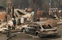 |
| Click Image to Enlarge |
|
|
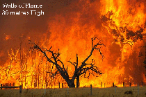 |
| Click Image to Enlarge |
|
|
 |
| Click Image to Enlarge |
|
|
 |
| Click Image to Enlarge |
|
|
 |
| Click Image to Enlarge |
|
|
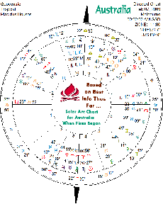
For Melbourne:
Standard Time Zone = UTC/GMT +10 hrs
Daylight Savings Time = +1 hr (+11 hrs)
For time of Victoria Fires: +11 hrs. (EDT)
DST ends on Sunday April 5, 2009 at 3:00 AM Local Daylight Time
DST starts on Sunday October 4, 2009 at 2:00 AM Local Standard Time
|
 |
| Click Image to Enlarge |
|
|
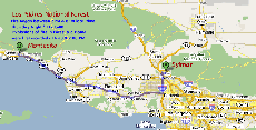
CALIFORNIA'S
MONTECITO
"TEA" FIRE
There is nothing good
about a fire such as this;
but the documentation for this fire
is very, very good....
so it does help to generate
good charts for future study
|
Like Australia, California is used to Fires. The Santa Ana Winds bring the possibility every year.
However, also like Australia, the Montecito Fires garnered headlines to the effect that:
"CALIFORNIA IS BURNING"
Also like Australia, it was Southern Calilfornia.
Then, in Feb of 2009; while Australia was burning in the South & Flooding in the North: Los Angeles ... was experiencing flooding and worry about mudslides from the devastation left by the Montecito and other Fires.
|
 |
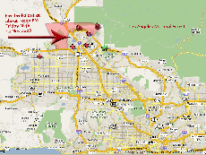
| Imagine its the Middle of the Night: You Have to Run for Your Life: While at the same time; a Firefighter Runs to Risk His ..... This is California |
|
|
 |
| Click Image to Enlarge |
|
|
 |
| Click Image to Enlarge |
|
|
| Montage of Montecito Fire Scenes & Events |
To the right →
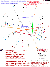
is the Radix Chart of the Montecito Tea Fire
|
 |
| Click Image to Enlarge |
|
|
|